Thursday, October 28, 2010
Online satellite maps
Publisher: Google and Microsoft
Price: Free
Purpose: View the trails from above.
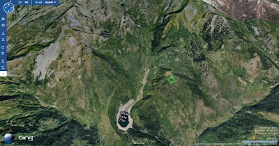
Satellite maps are great for obvious reasons -- quickly browsing over real views of the terrain. Google and Microsoft each have an online map site that is fairly easy to use and both offer free stand-alone applications with additional features that integrate back, somewhat seamlessly, with the browser view.
Both sites are useful in different ways. At the very least, the images are taken at different times. For example, when I was looking for better trail detail in a certain area, the image from one was taken in the winter, so the trails were covered in snow. The other was summer and looked great.
There are also less obvious reasons to use these sites. Microsoft has a feature that I hope will be adopted by Google, and although it needs some work and doesn't have very good coverage, it makes me giddy just thinking about the possibilities. Its the "Bird's eye" view, which uses images from low flying planes. This gives beautiful elevation views that don't have the distorted CGI look that overlaying satellite images on elevation profiles gives when trying to see real detail.
The downside of these sites is that I have found it hard to do much with their satellite maps besides browse them while at my computer. I tried printing a couple of views that I wanted to take with me and they ended up being less than helpful. I am not sure if this is because I couldn't get the detail I needed or if the maps just tend to work better interactively.
Subscribe to:
Post Comments (Atom)


No comments:
Post a Comment